Don’t ask me what is between Rockhampton and Serena (just south of Mackay) – the answer is nothing! Just miles and miles of country like this.It went on forever (or at nearly 300 km).

Back to Rockhampton for a minute. We were interesterd to see a few more of the classic old buildings in the town. One of them was this enormous Walter Reid Warehouse. This solid Victorian style building was completed in 1894 as warehouses for Walter Reid & Company. It was used by the US Forces as accommodation for troops during World War II. It is now used as a cultural centre.

The only major centre on the road after Rockhampton turned out to be a service station. It was at a place called Marlborough. There was an enormous sign pointing to the town centre, one kilometre away, but we drove around and there was absolutely nothing there – just a camping and caravan area at the servo.

Across the road, there were at least some signs of habitation with a property that bred stud brahmin cattle.

Back on the road again,the one thing that did keep us entertained were the many signposts on the side of the road. They were all trying to get drivers to take a rest if they were too tired.
▪ Tired drivers die
▪ Survive this drive
▪ Take a break
▪ Break the drive, stay alive
▪ Driver fatigue kills, rest if sleepy
▪ Rest or R.I.P.
Then there were other signs like “Still a long way to go kids.” That was followed a little later with “How long to go dad?” Just to keep the family together, there was a sign that said “How long to go Mum?”
We were even offered the opportunity to play trivia to keep us alert. The first question on a large sign was “What is the floral emblem of Queensland?” We passed that sign and a few minutes later another sign told us that the answer was the Cooktown Orchid.
About halfway along this drive is what appeared to be, according to the map, the ideal town to stop off at for a rest and some refreshments. It was called Clairview, and I thought it would be a great place for me to get out and stretch my legs. It was a beach town, so maybe I could go for a walk along the beach.
We found a picnic shelter all on its own and stopped for lunch The tide was out and the beach consisted of very broad tidal sand flats. I was impressed with the tenacity of one mangrove tree growing well out from the shore.


Our interest levels increased after turning of the Bruce Highway at Serina to head towards the mountains and Eungella (pronounced yungila). This is where sugar growing became intense.

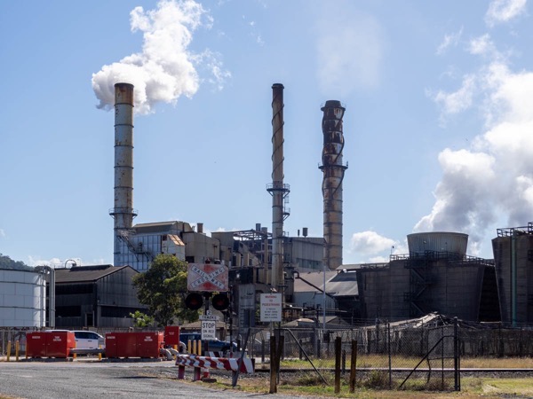
We passed an enormous mill at Serina and for the last hour of our trip today we came across lots of narrow guage railways that fanned out from the mill to transport sugar from the fields.

The end of our journey was marked by a very steep climb up to the town of Eungella whch is located on top of he Great Dividing Range. There were many sharp curves and blind corners. We found our cabin and settled in. This is a place for hippies. It only has a population of about 150 people. There are some houses and ramshackle buildings. The cafe which advertises meals from 6.30 to 9.30 pm has a notice on the door saying, “Sorry, we have closed down”. The cabins in which we are staying are part of the business of the Eungella Chalet. it would have thrived in the 1940s and nothing about its appearance has changed. We bought some take away meals from there for dinner.

Eungella is famous for its platypus pool in the nearby national park. As it was late in the afternoon, I thought that I would take my chances and see if I could spot one. I might have seen a shadowy object on the surface but otherwise, the pool was very pretty.

On the way back to the cabin, I called in to a lookout area with an appropriate name of ‘Sky Window’ and had a wonderful late afternoon view back across the plains and the sugar fields.


Rockhampton is interesting and the distances are large. When we went there we put our car on the train at Spencer Street and took it off at Murwillumbah not far from the Queensland border.
We visited Mount Morgan gold mine and much to Sue’s disgust the abattoirs with an aroma all of its own.
Enjoying your trip thanks Bruce.
Ian/Sue